Home » Technology » Augmented Reality maps for self driving cars
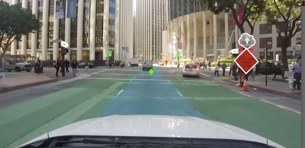
Have you heard of a startup named “Civil Maps”? If not, you will soon. They just announced today an augmented-reality component to its 3D mapping technology. It basically overlays street signs and other traffic. The AR component is an addition to Civil Map’s platform, which builds for self-driving cars.
We tend to think of maps as 2D, but Civil Maps takes a different approach. With the Civil Maps model, a self-driving car compares what its sensors perceive of the outside world, including lane markings and signage, with an internal map, and correlates that reference with GPS coordinates.
For example, if the car’s sensors picks up a sign not in its onboard map, it will upload the new information about the object to the Civil Maps’ servers. As more cars detect the same object, Civil Maps will dynamically update its map model and transmit it to all other cars.
The intent of this kind of technology is to eliminate the 95% of fatal car accidents which are attributable to human error.
For more information, go to: http://cnet.co/2cFtWgH